


Driving Distances From Sedona, Arizona
Reviewed and updated by AZ Leisure Staff Writers on
Use this Sedona mileage guide to estimate driving distances from Sedona, Arizona to popular cities, attractions and road-trip destinations throughout Arizona and the Southwest. Distances are approximate and can vary depending on your starting point in Sedona, destination address, route selection, construction, weather and road conditions.
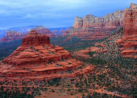 Bell Rock in Sedona Arizona. © Mike Koopsen
Approximate Driving Distances From Sedona
The following distances are approximate road miles from Sedona. Actual mileage can vary depending on your exact starting point, destination and route.
- Albuquerque, NM — approximately 350 miles
- Cottonwood, AZ — approximately 19 miles
- Durango, CO — approximately 340 miles
- Flagstaff, AZ — approximately 29 miles
- Grand Canyon South Rim — approximately 114 miles
- Grand Canyon North Rim — approximately 236 miles
- Grand Canyon West / Skywalk — approximately 200 to 250 miles depending on destination and route
- Jerome, AZ — approximately 24 miles
- Lake Havasu City, AZ — approximately 232 miles
- Las Vegas, NV — approximately 278 miles
- Los Angeles, CA — approximately 478 miles
- Page / Lake Powell, AZ — approximately 158 miles
- Phoenix, AZ — approximately 115 miles
- Prescott, AZ — approximately 67 miles
- San Diego, CA — approximately 461 miles
- Scottsdale, AZ — approximately 122 miles
- Show Low, AZ — approximately 165 miles
- Tombstone, AZ — approximately 299 miles
- Tucson, AZ — approximately 232 miles
- Williams, AZ — approximately 60 miles
- Yuma, AZ — approximately 291 miles
Popular Day Trips From Sedona
Several destinations on the mileage chart work especially well as Sedona day trips. Flagstaff, Cottonwood and Jerome are relatively close, while Williams and the Grand Canyon South Rim can also be visited in a day with an early start. Longer drives such as Las Vegas, Lake Havasu City, Tucson, Page and the Grand Canyon North Rim are generally better suited to overnight trips or longer road-trip itineraries.
The drive between Sedona and Flagstaff on State Route 89A passes through Oak Creek Canyon and is itself one of northern Arizona’s scenic attractions. Travelers headed toward Jerome can follow State Route 89A through Cottonwood and the Verde Valley.
Sedona Driving & Route Planning Tips
- Use mileage figures as planning estimates rather than exact door-to-door distances.
- Allow additional travel time during weekends, holidays and peak visitor periods.
- Mountain routes such as State Route 89A through Oak Creek Canyon and toward Jerome include curves, grades and slower traffic.
- Winter weather can affect higher-elevation roads around Flagstaff, the Grand Canyon and northern Arizona.
- Summer monsoon storms, wildfires and road construction can occasionally cause delays or temporary closures.
- Check current highway conditions before longer trips, especially when traveling through mountain or remote areas.
Sedona Driving Distance FAQ
How far is Sedona from Phoenix?
Sedona is approximately 115 miles from central Phoenix, depending on the exact starting and ending points. Phoenix Sky Harbor International Airport is about 120 road miles from Sedona.
How far is Sedona from Flagstaff?
Flagstaff is approximately 29 miles from Sedona by the scenic State Route 89A route through Oak Creek Canyon. Driving distance can increase when alternate routes are required.
How far is Sedona from the Grand Canyon?
The Grand Canyon South Rim is approximately 114 miles from Sedona and generally requires about two hours of driving under normal conditions. The North Rim is much farther at approximately 236 miles and is seasonally accessible.
How far is Jerome from Sedona?
Jerome is approximately 24 miles by road from Sedona, depending on the starting point and route. The drive follows the Verde Valley toward Cottonwood and then climbs State Route 89A to Jerome.
How far is Las Vegas from Sedona?
Las Vegas is approximately 278 to 280 miles from Sedona by road. Actual mileage varies with the route and destination within the Las Vegas metropolitan area.
How far is Sedona from Page and Lake Powell?
Page, Arizona and the Lake Powell area are approximately 158 miles from Sedona by common driving routes.
Are Sedona driving distances exact?
No. Mileage figures are approximate because distances vary according to the exact starting point in Sedona, destination address, selected route, construction and road conditions.
What is the best way to check current road conditions near Sedona?
Before a longer drive, check current Arizona highway conditions and weather forecasts, particularly for State Route 89A, Interstate 17 and roads serving the Grand Canyon and northern Arizona.
See All Sedona Has To Offer











