


West Fork Oak Creek Trail No. 108
Reviewed and updated by AZ Leisure Staff Writers on
West Fork Trail No. 108 is one of Oak Creek Canyon's signature hikes, following the West Fork of Oak Creek through a shady canyon of towering cliffs, pine, oak and maple trees. Located about 9.5 miles north of Sedona along State Route 89A, the maintained first three miles provide a scenic out-and-back hike with repeated creek crossings, while travel beyond the maintained trail becomes considerably more demanding.
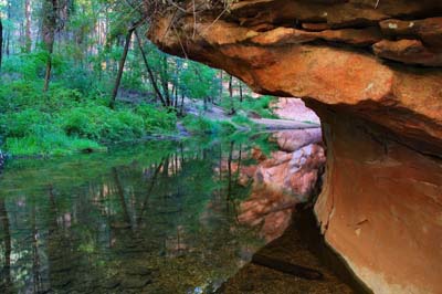 West Fork Oak Creek Trail. © Valerie Millett
- Current Trail Status
- Trail Overview
- Creek Crossings & Safety
- Best Time To Hike
- Trail Photos
- Parking & Access
- Directions
- Trail Details
- Trail Map
- FAQ
Current West Fork Trail Status
Temporary Closure: West Fork Trail No. 108 and the Call of the Canyon recreation area are currently closed under a Coconino National Forest emergency order because of flash-flood and debris-flow hazards in areas affected by the Pocket Fire. The current closure is scheduled through September 30, 2026, unless rescinded earlier or extended.
Do not enter a closed trail or recreation area. Because closures, weather and creek conditions can change quickly, hikers should check current Coconino National Forest alerts before traveling to West Fork.
West Fork Oak Creek Trail Overview
West Fork follows a remarkably scenic side canyon of Oak Creek Canyon, where the trail winds beside flowing water beneath steep sandstone walls. Pine, oak, maple, aspen and other riparian vegetation provide substantially more shade than hikers encounter on many of Sedona's exposed red-rock trails.
The maintained portion extends approximately three miles into the canyon, creating a popular hike of about six miles round trip for visitors who turn around at the end of the maintained trail. The grade is generally gentle, but rocks, uneven surfaces and repeated creek crossings mean hikers should not treat the route as an effortless paved walk.
Seasonal changes are a major part of West Fork's appeal. Spring brings fresh vegetation and wildflowers, summer provides a shady retreat from more exposed trails, autumn transforms the canyon with red and gold foliage, and winter can bring snow, ice and frozen surfaces. Conditions along the creek can vary significantly after storms and during snowmelt.
The narrow canyon and flowing creek create beautiful scenery, but they also require hikers to pay attention to weather. Heavy rainfall upstream can cause water levels to rise and may create flash-flood hazards even when conditions at the trailhead initially appear manageable.
Creek Crossings & Trail Safety
Creek crossings are one of the defining features of West Fork Trail. Under favorable conditions hikers can often cross on stepping stones or by walking through shallow water, but depth, current and footing change with rainfall, snowmelt and recent storms. Shoes with secure traction that can tolerate getting wet are a practical choice.
Never rely on an expected water depth when deciding whether a crossing is safe. Turn around when water is swift, unusually deep or rising, and avoid entering the narrow canyon when thunderstorms or flash flooding are possible. Winter hikers should also watch for ice on shaded portions of the trail and around creek crossings.
Beyond The Maintained Trail
The maintained trail ends after approximately three miles. Beyond this point, travel becomes substantially more difficult as the canyon narrows and hikers increasingly follow the creek and streambed rather than a maintained footpath.
Do not treat the upper canyon as simply an extension of the easy lower hike. Longer trips require appropriate wilderness experience, route planning, water-resistant equipment and careful attention to weather and creek conditions. Camping, fire and wilderness regulations may apply, so hikers planning an extended or overnight trip should verify current Coconino National Forest rules before entering the backcountry.
Best Time To Hike West Fork Trail
West Fork offers a different experience in every season. Spring generally brings mild hiking conditions and fresh canyon vegetation. Summer offers substantial shade, although monsoon storms can increase flash-flood risk. Autumn is especially popular for red, orange and gold foliage and can bring heavy trailhead demand. Winter is quieter and can be beautiful after snowfall, but ice, cold water and slippery creek crossings require additional caution.
Regardless of season, check the weather, current Forest Service alerts and trail access before leaving for Oak Creek Canyon. Fall weekends and other peak periods can bring particularly heavy demand for the limited trailhead parking.
West Fork Trail Photos By Valerie Millett
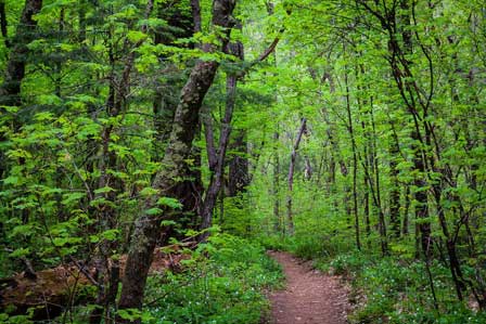
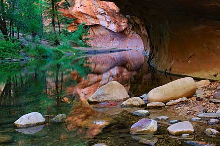
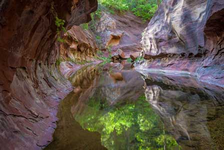
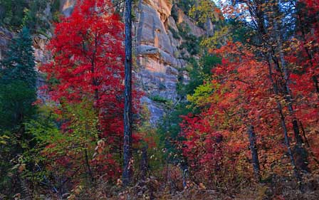
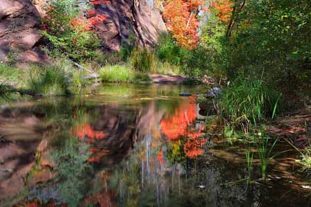
Valerie Millett has captured the changing character of West Fork Trail and Oak Creek Canyon, from quiet reflections beneath the canyon walls to the brilliant colors of autumn. Her photographs are presented here for viewing and may not be reused without advance permission. View more photos from her West Fork Trail gallery or visit Valerie's Blog for additional Arizona photography.

West Fork Trail Access, Parking & Fees
West Fork Trail begins at the Call of the Canyon recreation site on the west side of State Route 89A in Oak Creek Canyon, approximately 9.5 miles north of Sedona. The site provides the primary trailhead access for West Fork Trail No. 108.
Call of the Canyon is a concession-operated day-use area with a separate entrance or parking fee when open. Standard Red Rock Pass rules do not necessarily apply at this concession site, so visitors should check current Coconino National Forest information for accepted passes and current fees before traveling.
Parking is limited and the site can become extremely busy during weekends, holidays and peak fall-color periods. Arriving early can improve the chance of obtaining legal parking, but hikers should never park where roadside restrictions prohibit it.
Directions To West Fork Trail
From Phoenix
Take Interstate 17 north from the Phoenix area to Exit 298 for State Route 179. Follow SR 179 north through the Village of Oak Creek to its junction with State Route 89A in Sedona. Turn right onto SR 89A and continue north through Uptown Sedona and into Oak Creek Canyon. Call of the Canyon and the West Fork trailhead are approximately 9.5 miles north of Sedona on the west side of SR 89A.
From Flagstaff
Follow State Route 89A south from Flagstaff through Oak Creek Canyon toward Sedona. Call of the Canyon is on the west side of SR 89A roughly 17 miles south of Flagstaff. Watch carefully for the entrance because traffic and canyon curves can make turns easy to miss.
Video of West Fork Trail In Oak Creek Canyon
West Fork Trail Details & Hiking Tips
The Call of the Canyon day-use area serves as the trailhead for West Fork Trail No. 108. The maintained trail extends approximately three miles into the canyon, creating an out-and-back hike of roughly six miles for hikers who return from the end of the maintained section.
The lower trail has a relatively gentle grade but includes uneven terrain and repeated creek crossings. Allow enough time for water crossings, photographs and changing trail conditions rather than planning solely around walking speed.
Dogs are permitted where current Forest Service rules allow, but should remain leashed and under control. Pack out pet waste and all other trash.
Wear comfortable hiking footwear with dependable traction and expect the possibility of wet feet. Carry drinking water, snacks, sun protection and appropriate layers even though much of the trail is shaded. Before hiking, check weather forecasts, flash-flood potential and current Coconino National Forest alerts.
West Fork Oak Creek Trail Map
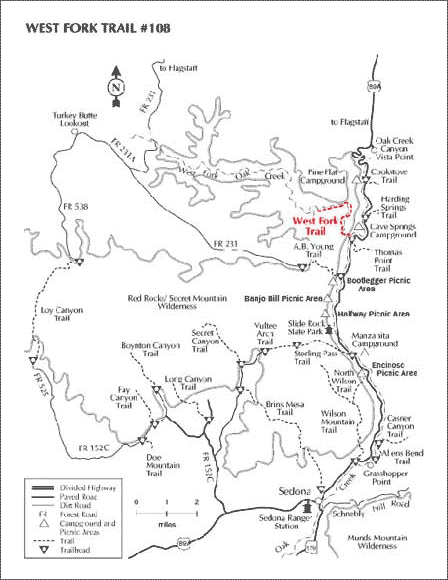 Map of the West Fork Trail in Oak Creek Canyon
For Current Trail Information
Before visiting West Fork Trail, check current Coconino National Forest alerts, closures, weather-related restrictions, fees and recreation-site information. Conditions in Oak Creek Canyon can change because of storms, flooding, wildfire impacts, winter weather and seasonal operations.
Red Rock Ranger District
Coconino National Forest
Sedona, Arizona
West Fork Oak Creek Trail FAQ
Where is West Fork Oak Creek Trail?
West Fork Trail No. 108 is in Oak Creek Canyon approximately 9.5 miles north of Sedona along State Route 89A. The trail begins at the Call of the Canyon recreation site.
How long is West Fork Trail?
The maintained portion extends approximately three miles into the canyon, making the standard out-and-back hike roughly six miles round trip. Travel beyond the maintained section becomes substantially more difficult.
Does West Fork Trail cross the creek?
Yes. Hikers cross the West Fork repeatedly along the maintained trail. Crossing conditions vary with rainfall, snowmelt and creek levels, so hikers should be prepared for wet and slippery footing.
Is West Fork Trail difficult?
The maintained lower trail has a relatively gentle grade, but its length, uneven surfaces and repeated creek crossings add difficulty. The unmaintained upper canyon is substantially more demanding and requires greater preparation and wilderness experience.
Where do you park for West Fork Trail?
The primary parking area is at the Call of the Canyon recreation site on State Route 89A. It is a concession-operated day-use site with limited parking and a separate fee when open.
What is the best time to hike West Fork Trail?
West Fork can be scenic throughout the year, with spring vegetation, summer shade, autumn foliage and occasional winter snow. Autumn is especially popular, while summer monsoon storms and winter ice can create additional hazards. Always check current conditions before hiking.
Can dogs hike West Fork Trail?
Dogs are permitted when current Forest Service regulations allow, but they should remain leashed and under control. Owners should carry out all pet waste.
Is West Fork Trail currently open?
As of September 12, 2026, West Fork Trail No. 108 and the Call of the Canyon recreation area are temporarily closed under a Coconino National Forest emergency order related to flash-flood and debris-flow hazards. Because closure dates can change, check current Forest Service alerts before visiting.
Enjoy Hiking In The Sedona Area











